Deskripsi
Sounding accuracy
3 @
CHC Navigation Headquarter
Shanghai Huace Navigation Technology Ltd.
577 Songying Road, Qingpu,
201703 Shanghai, China
+86 21 54260273
CHC Navigation Europe
Infopark Building , Sétány 1, 1117
Budapest, Hungary
+36 20 235 8248
+36 20 5999 369
info@chcnav.eu
CHC Navigation USA LLC
6380 S.Valley View Blvd Suite 246
Las Vegas, NV 89118 USA
+1 702 405 6578
CHC Navigation India
409 Trade Center, Khokhra Circle,
Maninagar East, Ahmedabad,
Gujarat, India
+91 90 99 98 08 02
WWW.CHCNAV.COM | MARKETING@CHCNAV.COM
7 kg
IP65
Electric
Veering without steering engine
Automatic return in case of low battery or
signal loss
Two-color light (Display positioning signal)
7,000 rpm
6 hours @ 2 m/s
(operating time can be extended by
adding batteries)
1 m x 0.65 m x 0.3 m
3rd wind level and 2nd wave level
25 kg
SPECIFICATIONS
* Specifications are subject to change without notice.
(1) CHCGD is CHCNAV format.
© 2023 Shanghai Huace Navigation Technology Ltd. All rights reserved. The CHCNAV and CHCNAV logo are
trademarks of Shanghai Huace Navigation Technology Limited. All other trademarks are the property of their
respective owners. Revision February 2023.
Type
Direction control
Auto-return
Indicator light
Weight (w/o instrument
and battery)
Waterproof
Maximum motor speed
Battery endurance
Hull dimension
(L × W × H)
Anti-wave & Wind
Draft
Hull design
Propeller type
Video
10 cm
Triple-hull vessel
Brushless DC
700 W
6 m/s
30 000 mAh, 23.1Ah
15 000 mAh, 32.4V
Li-ion battery capacity
Maximum motor power
Maximum speed
360° omnidirectional video
Maximum payload
Physical
Power
Communication
Positioning
D230 Single Beam Echo Sounder
Network bridge and 4G for data, video
and RTCM corrections
Data communication
2.4 GHz radio, network bridge and 4G
eSIM and nano SIM
432
0.2 ⁰ @1 m baseline
Data type
R/C communication
SIM Card slot
Channel
Heading accuracy
Manual or Auto-Pilot
1.1 kg
200 kHz
10-30 V DC/ 220 V AC
±0.01 m + 0.1% x D
(D is the depth of water)
0.15 m to 200 m
0.01 m
6.5° ± 1°
6 ⁰/ h
Local multi-sessions and remote push
BDS B1/B2, GPS L1/L2, GLONASS L1/
L2, Galileo E1/E5, QZSS
Horizontal: 0.5 m
Vertical: 0.85 m
Horizontal: ±8 mm + 1 ppm
Vertical: ±15 mm + 1 ppm
Navigation mode
Weight
Frequency
Supply voltage
Sounding range
Resolution
Beam angle
Inertial navigation stability
Data storage
Satellite system
SBAS Positioning
accuracy
RTK Positioning
accuracy
2 x RJ45 port
2 x RS232 serial port
1 x RS485 serial port
1 x PPS
Interface
IP67
Horizontal: 1.5 m
Vertical: 2.5 m
Horizontal: 0.4 m + 1 ppm
Vertical: 0.85 m + 1 ppm
Single point position
(RMS)
DGNSS positioning
accuracy
Macromolecule polyester carbon fiberMaterial
Radio: 3 km, network bridge: 2 km and
4G: unlimited
Remote control Range
Waterproof of
master control
CHCGD (1)
, NMEA SDDPT/SDDBT,
original waveform
Active Obstacle Avoidance Millimeter Wave Obstacle Avoidance
Software
Hydro Survey
Path planning,autonomous navigation,
hull parameter control, multi-angle video
display
Auro Planner
Data collection and post-processing,
coordinate conversio
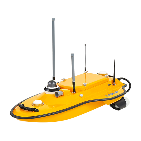
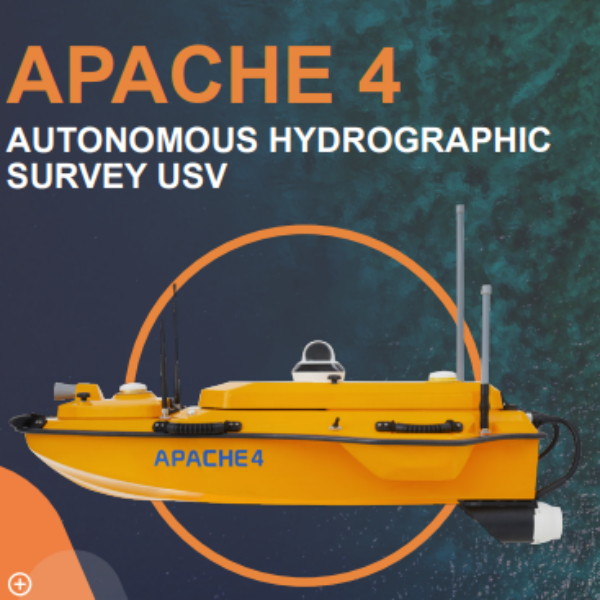
Beli Bathymetric USV Chc Nav Aphace 3, dengan harga ekonomis Gratis biaya pengiriman wilayah Tangerang dan dapat dikirim keseluruh Indonesia. Dapatkan hanya di toko online transsurvey.id belanja online mudah dan aman.


Ulasan
Belum ada ulasan.